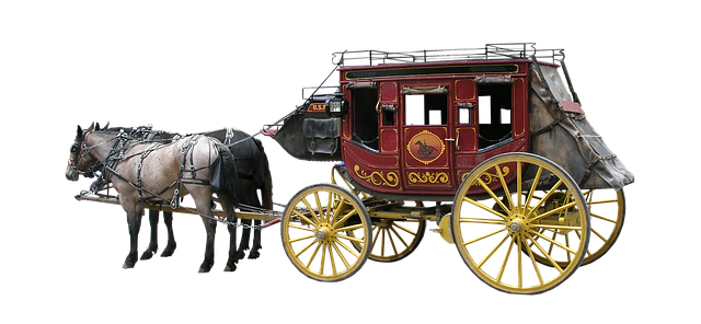
I’m taking a detour from my typical stories to talk about the history of the Dutchtown area. All of the areas around here were ceded to the United States by the Creek Indians on January 8, 1821, with the First Treaty of Indian Springs. I can tell from maps in the 1830s that the road we know today as Jonesboro Road existed at that time as the McDonough-Fayetteville Stagecoach Road. The roughly 19 mile trip between McDonough and Fayetteville via stagecoach would have taken close to 4 hours. That trip was probably not a non-stop, though, as I know there was a stagecoach stop in Dutchtown across the road from County Line Church. The original settlers of Dutchtown were members of the Ahls, Conkle, and Exum families. Even today. I know members of the Conkle and Exum families who still live in the area.
There is significant evidence that the Civil War Battle of Lovejoy’s Station worked its way down present-day Jonesboro Road as far down as where it intersects with Walnut Creek. We referred to that place as the ‘double bridges’ because of the two bridges that were there when I grew up. Regardless of where actual fighting took place, we know Union General Judson Kilpatrick and his troops passed through Dutchtown as they moved from Lovejoy to McDonough before turning north.
This Dutchtown history was surprising to me as I just assumed nothing happened around here other than farming. In my childhood days, there was very little traffic on Jonesboro Road. We played baseball in the front yard when a decent hit would cross the road. We just knew not to throw a pitch when a car was coming, which wasn’t much of an inconvenience. In football season, Jonesboro Road was the end zone.
When I was growing up, there weren’t any businesses on Jonesboro Road from the county line until you got to a small store at the intersection with Mt. Carmel Road. That wasn’t always true. My grandmother, Minnie Chaffin, had a store on the northwest corner of Jonesboro and Chambers Roads’ intersection. The building was still there when I grew up, but the store had been long closed. Even before that, Mrs. Alice Exum also had a store just east of Dutchtown Road at the top of the hill. Not even the opening of Interstate 75 in 1969 changed the scenery that much. We had one gas station/truck stop on the southeast corner of I-75 and Jonesboro Road, but that was it for years. Much has changed since then – there are probably 100 businesses in the vicinity of Jonesboro Road between I-75 and my house 1.5 miles west.
References:
Dutchtown High School History – https://schoolwires.henry.k12.ga.us/Domain/4624 (this is information from Henry County Historian Gene Morris, Jr. who lived just over the field from me. Gene and I were the same age, and he was my first friend that wasn’t related to me)
1837 map of Georgia – https://digitalarchives.columbusstate.edu/files/original/fd32855eaf1a6ed242964a3c2f2df393.png
Lovejoy Station Battlefield Map – https://en.wikipedia.org/wiki/Battle_of_Lovejoy%27s_Station#/media/File:Lovejoy’s_Station_Battlefield_Georgia.jpg